French Guiana: Difference between revisions
Jump to navigation
Jump to search
French Guyana (Guyane Française)
Knorrepoes (talk | contribs) m (Text replace - "78.000" to "79.000") |
Knorrepoes (talk | contribs) m (Text replace - "over 79.000" to "over 80.000") |
||
| Line 1: | Line 1: | ||
{|width="100%" style="color:brown;" | {|width="100%" style="color:brown;" | ||
|width="15%"|[[File:logo1.gif|left]] | |width="15%"|[[File:logo1.gif|left]] | ||
|width="70%" align="center" | <font size=x-large> '''Heraldry of the World<br>The main resource for civic heraldry since 1996 with over | |width="70%" align="center" | <font size=x-large> '''Heraldry of the World<br>The main resource for civic heraldry since 1996 with over 80.000 images''' </font> | ||
|width="15%"|[[File:logo1.gif|left]] | |width="15%"|[[File:logo1.gif|left]] | ||
|} | |} | ||
Revision as of 18:25, 31 March 2012
| Heraldry of the World The main resource for civic heraldry since 1996 with over 80.000 images |

|

|
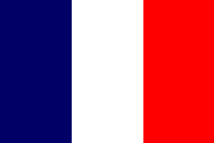
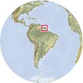
| The National Flag | Location |
National arms
French Guyana does not have any official arms. In many cases the arms of the capital Cayenne, are used as national arms.
Administrative division
French Guyana is a French Overseas Département, situated in South America, between Surinam and Brasil.
French Guyana is divided into 19 cantons and 22 communes.
Heraldry
Only a few of the municipalities use arms:
