Netherlands Antilles: Difference between revisions
Jump to navigation
Jump to search
Netherlands Antilles - Nederlandse Antillen
Knorrepoes (talk | contribs) (Created page with '{|width="100%" style="color:brown;" |width="15%"|left |width="70%" align="center" | <font size=x-large> '''Heraldry of the World<br>The main resource for civic…') |
Knorrepoes (talk | contribs) No edit summary |
||
| Line 9: | Line 9: | ||
{|width="100%" | {|width="100%" | ||
|align="center"|[[File:Nedant. | |align="center"|[[File:Nedant.gif|300 px]] | ||
|align="center"|[[File:Nedant-flag.gif]] | |align="center"|[[File:Nedant-flag.gif]] | ||
|align="center"|[[File:Nedant-location.jpg]] | |align="center"|[[File:Nedant-location.jpg]] | ||
Revision as of 08:49, 6 November 2010
| Heraldry of the World The main resource for civic heraldry since 1996 with over 60.000 images |
| File:Nedant.gif | 
|

|
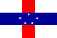
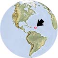
| The National Arms of the Netherlands Antilles | The National Flag | Location |
History
The Netherlands Antilles (Nederlandse Antillen) was a self governing territory within the Kingdom of the Netherlands. The federation consisted of 6 islands, Aruba, Bonaire, Curaçao, Saba, Sint Eustatius and Sint Maarten.
In 1986 Aruba became independent within the Kingdom of the Netherlands and left the federation.
In 2010 the Netherlands Antilles were abolished; Bonaire, Saba and Sint Eustatius became special overseas municipalities of the Netherlands. Curacao and Sint Maarten became, like Aruba, independent within the Kingdom of the Netherlands.
See also
and under the Netherlands for:
