Mayotte: Difference between revisions
Jump to navigation
Jump to search
Mayotte
Knorrepoes (talk | contribs) |
Knorrepoes (talk | contribs) m (Text replace - "flag.gif]] " to "flag.gif|border]] ") |
||
| Line 11: | Line 11: | ||
{|width="100%" | {|width="100%" | ||
|align="center"|[[File:Mayotte.gif]] | |align="center"|[[File:Mayotte.gif]] | ||
|align="center"|[[File:France-flag.gif]] | |align="center"|[[File:France-flag.gif|border]] | ||
|align="center"|[[File:Comoros-location.jpg]] | |align="center"|[[File:Comoros-location.jpg]] | ||
Revision as of 13:48, 1 January 2012
| Heraldry of the World The main resource for civic heraldry since 1996 with over 70.000 images |

|

|

|
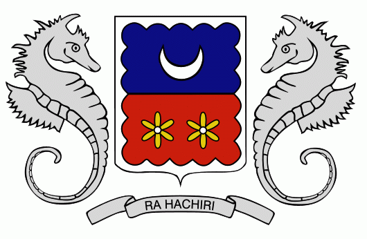
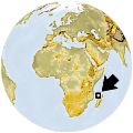
| The National Arms of Mayotte | The National Flag | Location |
Administrative division
Mayotte is a French Overseas Département, situated near the North-West of Madagascar, Africa.
Mayotte is divided into 17 communes. There are also 19 cantons each of which corresponds to one of the communes, except for the commune of Mamoudzou which is divided into three cantons
Heraldry
Nearly all of the municipalities use arms:
- Acoua
- Bandraboua
- Bandrélé
- Bouéni (does not use arms)
- Chiconi
- Chirongui
- Dembeni
- Dzaoudzi
- Kani-Kéli
- Koungou
- Mamoudzou
- M'Tsangamouji
- M'Tsamboro
- Ouangani
- Pamandzi
- Sada
- Tsingoni
